H. Sargeant Michaels Co.
Photographic Automobile Map of the Midwest, 1905
Printed book; 76 photo-lithographic illustrations and numerous advertisements
8 x 5 inches overall
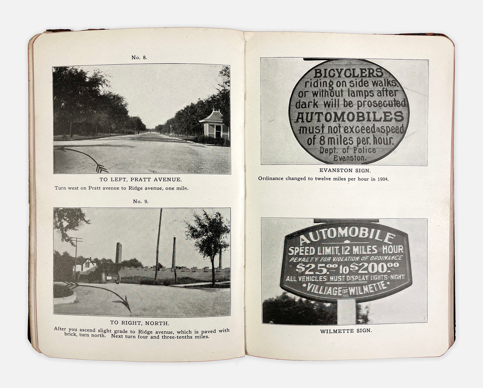
One hundred years before maps on our phones, this photographic road guide published by H. Sargent Michael Co. in Chicago, offered drivers a set of turn-by-turn, visual directions and help...
One hundred years before maps on our phones, this photographic road guide published by H. Sargent Michael Co. in Chicago, offered drivers a set of turn-by-turn, visual directions and help at befuddling intersections, as well as photo illustrations for automobile travel from Chicago to Lake Geneva, Delavan Lake, Delvan, and Beloit, returning via Antioch and Fox Lake Country. Aimed at the intrepid auto-tripper, the book includes numerous images showing early iterations of speed-limit signs, apparently produced and erected by whomever pleased to do so. The signs tout the hefty fines for those who exceed the limit (not unlike today!).
In Walter Ristow's A Half-Century of Oil-Company Road Maps (Quarterly Journal of the American Congress on Surveying and Mapping, Dec. 1964), he notes that "there was an active interest in photo auto guides around 1905 to 1910. Most common in the middle west, they seem to have been first introduced by H. Sargent Michaels who copyrighted several Photographic Automobile Maps in 1905."
It appears that publishers were unable to keep up with photographing the rapidly changing roadside landscape and discontinued to publish such visual mapping around the time that automobile ownership became mainstream.
